
The villages belonging to the Roman Catholic parish in Górno and named in both the Słownik Geograficzny Królestwa Polskiego and the Gemeindelexikon der im Reichsrate Vertetenen Konigreiche und Lander XII Galizien (1907)are: Dołega (half of this village was added to Wólka Niedźwiedzka in 1925), Górno, Zaborze, and Meszne. Other villages that once belonged to the parish in Górno include Biedzczów (part was separated into the Mazury parish in 1938), Kamień (separated in 1907), Korczowiska (part was separated into the Mazury parish in 1938), Łowisko (became an independent parish in 1975), and Markowizna.
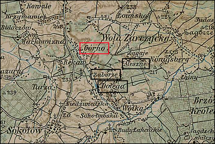
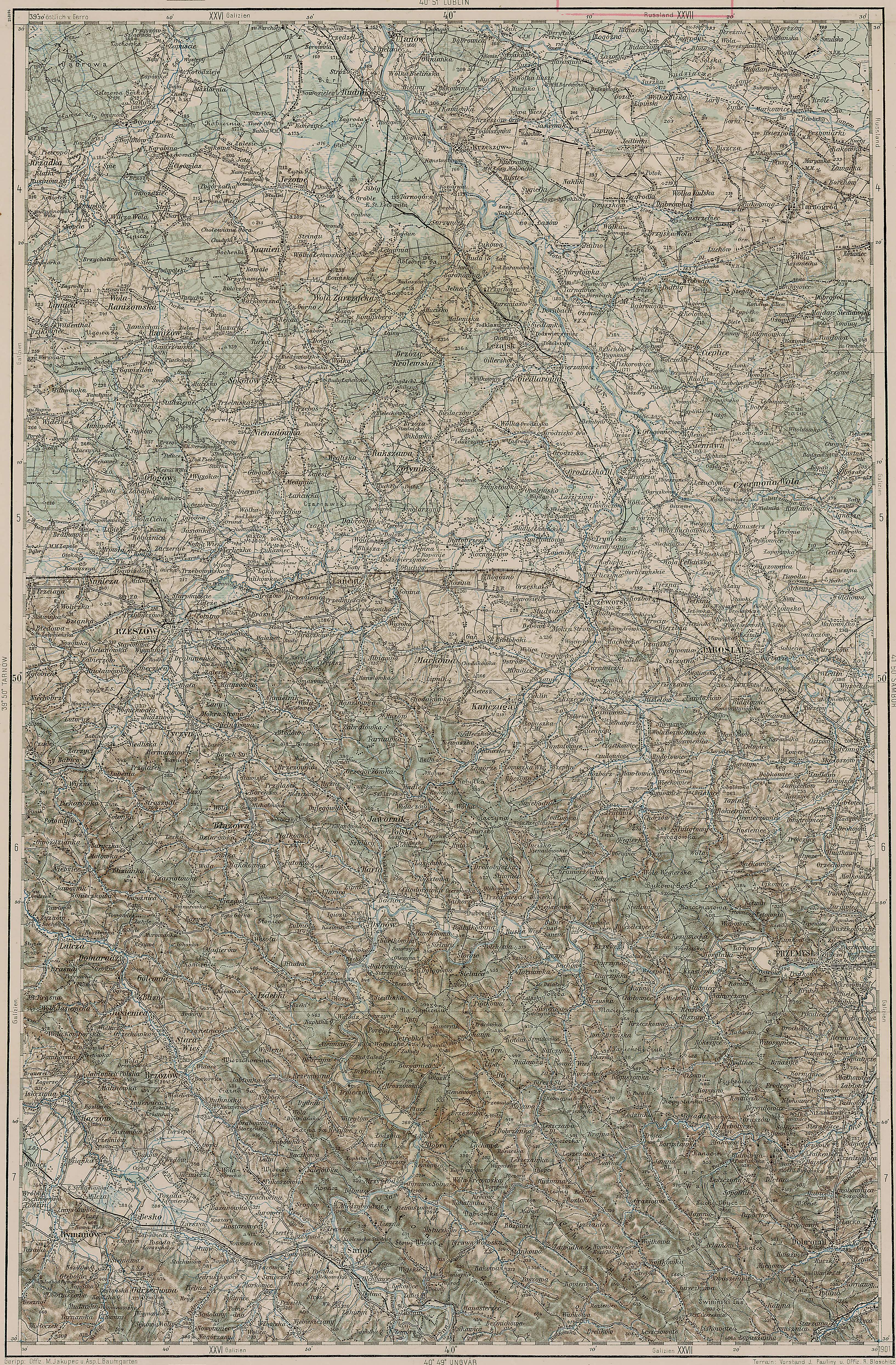
Górno Parish – 1910
Third Military Mapping Survey of Austria-Hungary (ELTE Faculty of Informatics,
Institute of Cartography and Geoinformatics); digital images, Lazarus ELTE
(http://lazarus.elte.hu/hun/digkonyv/topo/200e/40-50.jpg: accessed 01 May 2026)
The administrative structure to which Dołega, Górno, Zaborze, and Meszne belonged evolved as follows:
- 01 Jul 1569-22 Sep 1772: Village, Sandomierz Powiat, Sandomierz Voivodeship, Polish-Lithuanian Commonwealth
- 22 Sep 1772- Nov 1773: Village, Kingdom of Galicia and Lodomeria, Habsburg Monarchy
- Nov 1773-Nov 1777: Village, Kreis Red Ruthenia, Kingdom of Galicia and Lodomeria, Habsburg Monarchy
- Nov 1777-11 Aug 1804: Village, Kreis Rzeszów, Kingdom of Galicia and Lodomeria, Habsburg Monarchy
- 11 Aug 1804-Mar 1854: Village, Kreis Rzeszów, Kingdom of Galicia and Lodomeria, Austrian Empire
- Apr 1854-28 Mar 1867: Village, Kreis Rzeszów, Kraków Administrative Area, Kingdom of Galicia and Lodomeria, Austrian Empire
- 30 Mar 1867-10 Nov 1918: Village, Bezirk Kolbuszowa, Kingdom of Galicia and Lodomeria, Austria-Hungary
- 11 Nov 1918-20 Oct 1939: Village, Kolbuszowa Powiat, Lwów Voivodeship, Second Polish Republic
- 21 Oct 1939-27 Jun 1945: Village, District of Kraków, General Government, Nazi Germany
- 28 Jun 1945-21 Jul 1952: Village, Kolbiszowa Powiat, Rzeszów Voivodeship, Republic of Poland
- 22 Jul 1952-31 May 1975: Village, Kolbiszowa Powiat, Rzeszów Voivodeship, Polish People’s Republic
- 01 Jun 1975-30 Dec 1989: Village, Rzeszów Voivodeship, Polish People’s Republic
- 31 Dec 1989-30 Dec 1998: Village, Rzeszów Voivodeship, Third Polish Republic
- 31 Dec 1998-Present: Village, Rzeszów Powiat, Subcarpathian Voivodeship, Third Polish Republic
Copyright © 2026 by Stephen J. Danko


